| | Title | Description | Height | Width | File Size | |

| Colorado River Watershed with LCRA Facilities | Large wall size map of the entire watershed with major LCRA facilities and irrigation districts. | 35.0" | 88.0" | 3.2 MB |

|
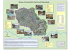
| Barons and Live Oak Creeks Watershed | This poster shows the watersheds of Barons and Live Oak Creeks in Gillespie County. It includes the city of Fredericksburg, water quality monitoring locations and results from biological sampling performed by LCRA. | 34.0" | 44.0" | 4.0 MB |

|
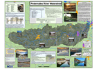
| Pedernales River Watershed | This poster shows the Pedernales River Watershed. The watershed is located in Kimble, Kerr, Gillespie, Blanco, Hays and Travis counties. The water flows across, through or under on its way to Lake Travis. | 36.0" | 44.0" | 5.2 MB |

|
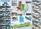
| Colorado River Basin | The Colorado River watershed covers more than 40,000 square miles, roughly the size of Kentucky. | 36.0" | 48.0" | 12.2 MB |

|
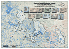
| Central Texas Watershed Posters | This map shows eleven watersheds that LCRA has assessed in detail for features that might affect water quality, to support the LCRA Highland Lakes Watershed Ordinance program. | 36.0" | 42.0" | 8.7 MB |

|
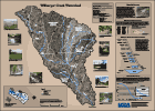
| Wilbarger Creek Watershed | This poster shows the Wilbarger Creek watershed in Northeast Travis County and Northwest Bastrop County. Wilbarger Creek enters the Colorado River in Bastrop County. | 36.0" | 48.0" | 5.8 MB |

|
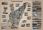
| Flat Rock Creek Watershed | Highways 71 and 281 intersect in this watershed south of Marble Falls where a new hospital and large development project are planned. This poster displays the effects of flash flooding that occurred in June 2007. | 36.0" | 48.0" | 10.3 MB |

|
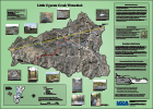
| Little Cypress Creek Watershed | Located in southernmost Burnet County, the Little Cypress Creek watershed includes the Krause Springs swimming hole near the community of Spicewood. Little Cypress Creek drains into Lake Travis. | 36.0" | 48.0" | 9.1 MB |

|
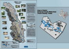
| Gilleland Creek Watershed | This poster shows the Gilleland Creek watershed in Northeast Travis County. Harris Branch, Decker Creek, Elm Creek and Gilleland Creek watersheds are included on this poster. | 48.0" | 36.0" | 7.2 MB |

|
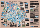
| Colorado River Watershed Austin to Smithville | Between Austin and Smithville tributaries that enter the Colorado River include Gilleland, Wilbarger, Big Sandy, Piney, Alum, Onion, Dry and Cedar creeks. | 36.0" | 48.0" | 25.2 MB |

|
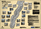
| Marble Falls Whitman Branch Watershed | This small creek drains an urbanized area within the City of Marble Falls. LCRA personnel walked the creek in 2003. This poster documents the conditions that existed prior to destructive flooding that occurred in June 2007. | 36.0" | 48.0" | 7.4 MB |

|
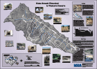
| Heinz Branch Watershed to Westcave Preserve | The Heinz Branch watershed is in the western most point of Travis County where Blanco, Hays and Travis counties converge. | 36.0" | 48.0" | 9.0 MB |

|
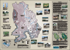
| Northwest Travis County Watersheds | This poster shows the watersheds in Northwest Travis County. Post Oak Creek, Big Sandy Creek and Cypress Creek watersheds are included on the poster. | 36.0" | 48.0" | 15.1 MB |

|
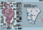
| Hamilton Creek Watershed | Hamilton Creek drains to Lake Travis. The creek is located in Burnet County and springs support its perennial flow. | 36.0" | 48.0" | 11.3 MB |

|
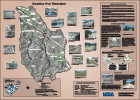
| Hamilton Pool Watershed | Hamilton Creek extends from the Shingle Hills to the Pedernales River downstream from Hammetts Crossing. The watershed is spilt between Travis and Hays counties. | 36.0" | 48.0" | 11.3 MB |

|
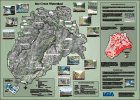
| Bee Creek Watershed | The Bee Creek watershed extends from the Shingle Hills near the Travis/Hays county line to the Bee Creek Road crossing near Lake Travis. | 36.0" | 48.0" | 14.0 MB |

|
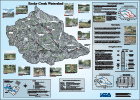
| Rocky Creek Watershed | Rocky Creek is a tributary to Barton Creek. The Rocky Creek Watershed is located in West Travis County. | 36.0" | 48.0" | 12.3 MB |

|
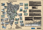
| Lick Creek Watershed | Lick Creek is a tributary to the Pedernales River, draining from south to north into Lake Travis near the State Highway 71 Bridge. | 36.0" | 48.0" | 17.5 MB |

|
